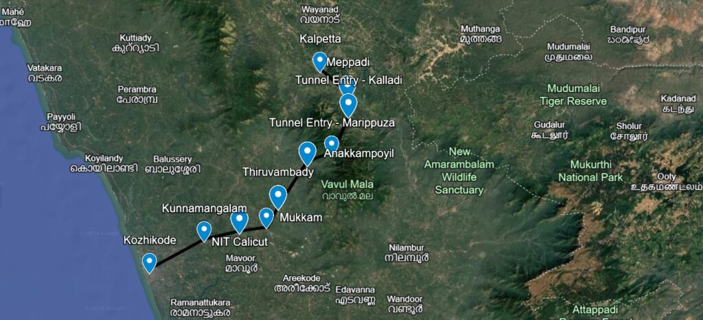
The Kozhikode Wayanad Tunnel Road Map shows the proposed alignment of the Anakkampoyil–Kalladi–Meppadi Tunnel, designed to provide a faster and safer alternative to the existing ghat road.Executed by the Konkan Railway Corporation (KRCL), this twin-tube tunnel will become the longest in Kerala, slashing travel distance by 22 km and saving commuters over 90 minutes of journey time.
Kozhikode - Wayanad SH 83 Road
The Kozhikode to Anakkampoyil route follows Kunnamangalam, Mukkam, and Thiruvambady via SH 83.
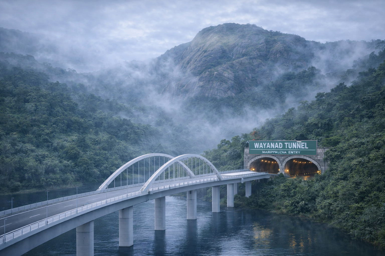
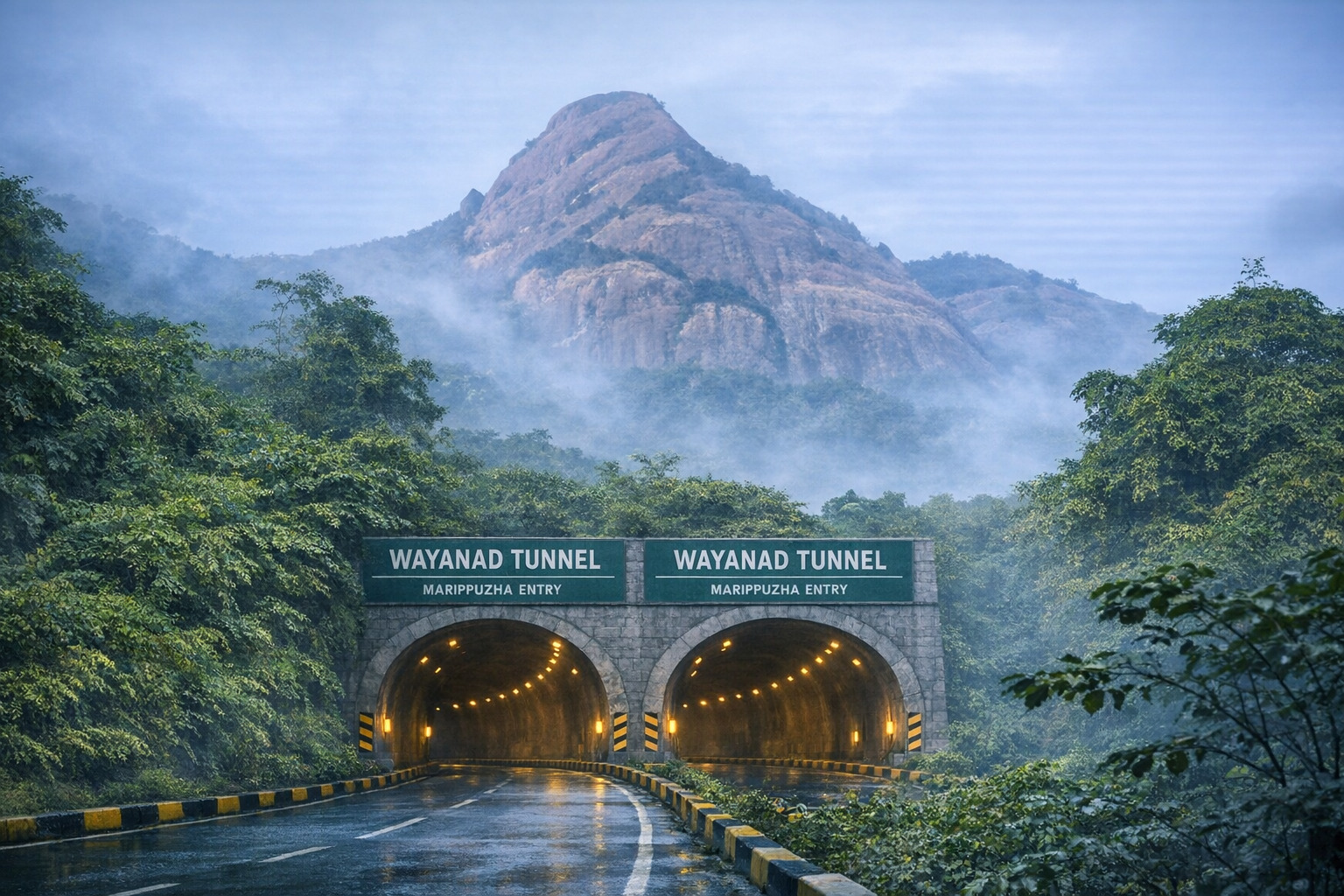
Marippuzha Gateway: At the Western Ghats foothills, the route crosses a 120-meter bridge over the Iruvazhinji River before entering the advanced 4-lane twin-tube tunnel.
From Meppadi to Kalpetta The Meppadi to Kalpetta stretch continues along SH 83 with smooth hill road connectivity.
Kozhikode - Wayanad SH 83 Route
Tunnel Highlights
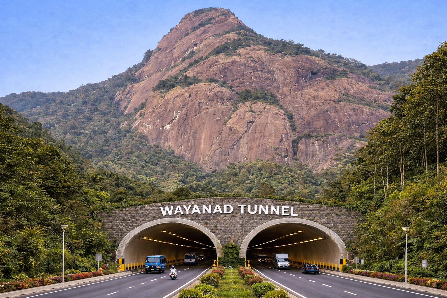
The Anakkampoyil–Kalladi–Meppadi Tunnel is a twin-tube tunnel with two lanes in each direction, with a total length of 8.73 km (5.58 km in Wayanad and 3.15 km in Kozhikode).
The entry point is at Marippuzha (Anakkampoyil), and the exit point is near Meenakshi Bridge (Kalladi).
Travel Comparison
Current Route (Kozhikode- Kalpetta)
Via Thamarassery Ghat Road
Time: 2.5 – 3 hours
Hairpins: 9
Tunnel Route
Hairpins: 0
Time: 1.5 hours
Why This Route is Important
This Kozhikode to Wayanad new tunnel route drastically reduces travel time by 1.5 hours and improves safety by providing a landslide-safe tunnel that avoids ghat roads.
The project serves as a vital all-weather corridor that will significantly boost tourism in Wayanad District and provide faster access to emergency healthcare and regional trade.
Alternative to Ghat Road
The Wayanad Tunnel Road will serve as a safer and more efficient alternative to the hazardous ghat roads, improving connectivity between Kerala and neighboring states like Karnataka and Tamil Nadu, and strengthening its role as an important trade and transport corridor.
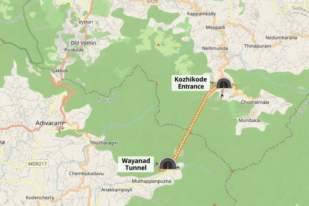
The Kozhikode Wayanad Tunnel Route Map follows a direct line from Anakkampoyil in Kozhikode to Meppadi in Wayanad, traversing through the Western Ghats to bypass the Thamarassery Churam.
This Kozhikode to Wayanad new route starts at the south portal in Marippuzha near Anakkampoyil and emerges at the north portal in Kalladi near the Meenakshi Bridge.
The Anakkampoyil Kalladi Meppadi Route slashes the travel distance between these two points from 42 km to approximately 20 km, effectively saving commuters over 90 minutes of journey time.